


GREEN BAY TWP Voting District, Lee County, Iowa
About
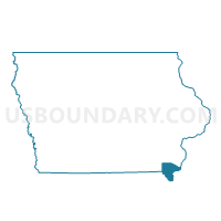
Outline

Summary
| Unique Area Identifier | 582602 |
| Name | GREEN BAY TWP Voting District |
| County | Lee County |
| State | Iowa |
| Area (square miles) | 38.23 |
| Land Area (square miles) | 33.57 |
| Water Area (square miles) | 4.65 |
| % of Land Area | 87.83 |
| % of Water Area | 12.17 |
| Latitude of the Internal Point | 40.68976780 |
| Longtitude of the Internal Point | -91.20589460 |
Maps


Graphs
Select a template below for downloading or customizing gragh for GREEN BAY TWP Voting District, Lee County, Iowa


Neighbors
Neighoring Voting District (by Name) Neighboring Voting District on the Map
- APPANOOSE Voting District, Hancock County, IL
- CONCORDIA TWP Voting District, Des Moines County, IA
- DALLAS CITY Voting District, Hancock County, IL
- DENMARK TWP Voting District, Lee County, IA
- FORT MADISON PART W/ JEFFERSON TWP & WASHINGTON TWP PARTS Voting District, Lee County, IA
- LOMAX Voting District, Henderson County, IL
- PONTOOSUC Voting District, Hancock County, IL
- UNION TWP Voting District, Des Moines County, IA
- WASHINGTON TWP PART W/O FORT MADISON PART Voting District, Lee County, IA
Top 10 Neighboring County Subdivision (by Population) Neighboring County Subdivision on the Map
- Madison township, Lee County, IA (10,843)
- Washington township, Lee County, IA (1,569)
- Dallas City township, Hancock County, IL (996)
- Lomax township, Henderson County, IL (850)
- Denmark township, Lee County, IA (804)
- Union township, Des Moines County, IA (777)
- Concordia township, Des Moines County, IA (714)
- Green Bay township, Lee County, IA (566)
- Appanoose township, Hancock County, IL (435)
- Pontoosuc township, Hancock County, IL (413)
Top 10 Neighboring Place (by Population) Neighboring Place on the Map
Top 10 Neighboring Elementary School District (by Population) Neighboring Elementary School District on the Map
Top 10 Neighboring Secondary School District (by Population) Neighboring Secondary School District on the Map
Top 10 Neighboring Unified School District (by Population) Neighboring Unified School District on the Map
- Burlington Community School District, IA (29,942)
- Fort Madison Community School District, IA (17,311)
- Nauvoo-Colusa Community Unit School District 325, IL (2,297)
Top 10 Neighboring State Legislative District Lower Chamber (by Population) Neighboring State Legislative District Lower Chamber on the Map
- State House District 94, IL (100,005)
- State House District 92, IA (28,301)
- State House District 87, IA (27,761)
- State House District 91, IA (27,706)
Top 10 Neighboring State Legislative District Upper Chamber (by Population) Neighboring State Legislative District Upper Chamber on the Map
- State Senate District 47, IL (203,948)
- State Senate District 46, IA (56,007)
- State Senate District 44, IA (55,643)
Top 10 Neighboring 111th Congressional District (by Population) Neighboring 111th Congressional District on the Map
Top 10 Neighboring Census Tract (by Population) Neighboring Census Tract on the Map
- Census Tract 4902, Lee County, IA (5,495)
- Census Tract 9735, Henderson County, IL (2,948)
- Census Tract 12, Des Moines County, IA (2,581)
- Census Tract 9540, Hancock County, IL (2,544)
- Census Tract 4903, Lee County, IA (2,258)
- Census Tract 9539, Hancock County, IL (1,993)